No doubt about it: Denny and I are spoiled New Yorkers. We have a car. But for a long time–the first years of Escape Brooklyn, actually–we didn’t. Instead, we somehow managed to launch a travel website without one, making the most public transportation like the MetroNorth, NJ Transit trains, and even Adirondack Trailway busses to find the best hiking near NYC (amongst other things.) Every weekend for several years, we found ourselves in the pursuit of fresh air, schlepping ourselves, our hiking gear, and our weekend bags upstate via public transportation. Hell, we even camped off the MetroNorth–and you can too!
Every spring, as the weather inevitably warms, our inbox inevitably fills with emails asking for the best hiking near NYC using public transportation. There’s a lot of these “best hiking near NYC” lists floating around out there, but we created yet another because we don’t believe that many of the authors of those articles actually stepped foot on a trail. (Kudos if they did, but we find it hard to believe that they were able to complete all the hikes in the huge, overwhelming lists that they create.) Even more frustrating, these articles are often missing key information–getting to the trailhead from the train is a common one–and none of them mention what else is in the area… as if you don’t want to know where to pick up trail snacks and water for the hike, or even where to have a victory beer before catching the train home?!
So remaining true to what sets us apart from them, here’s a short list of fantastic hikes that we’ve actually done, using our own photography, with a couple ideas for how to best spend the rest of your afternoon (or weekend) during your time in each of these beautiful areas. We hope the result is slightly more inspiring than those other “best hiking near NYC” lists.
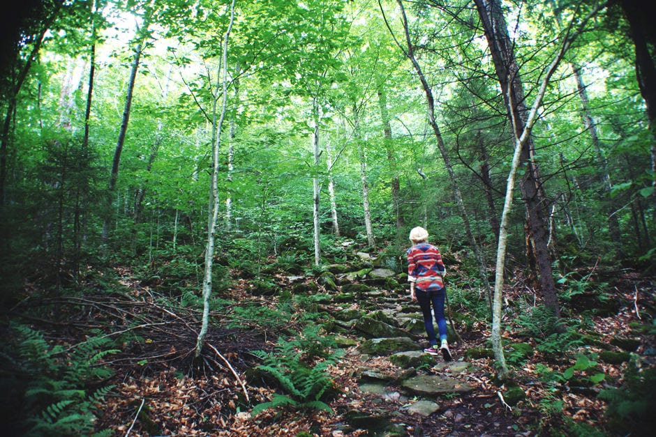
Mount Beacon in Beacon, NY
![]()
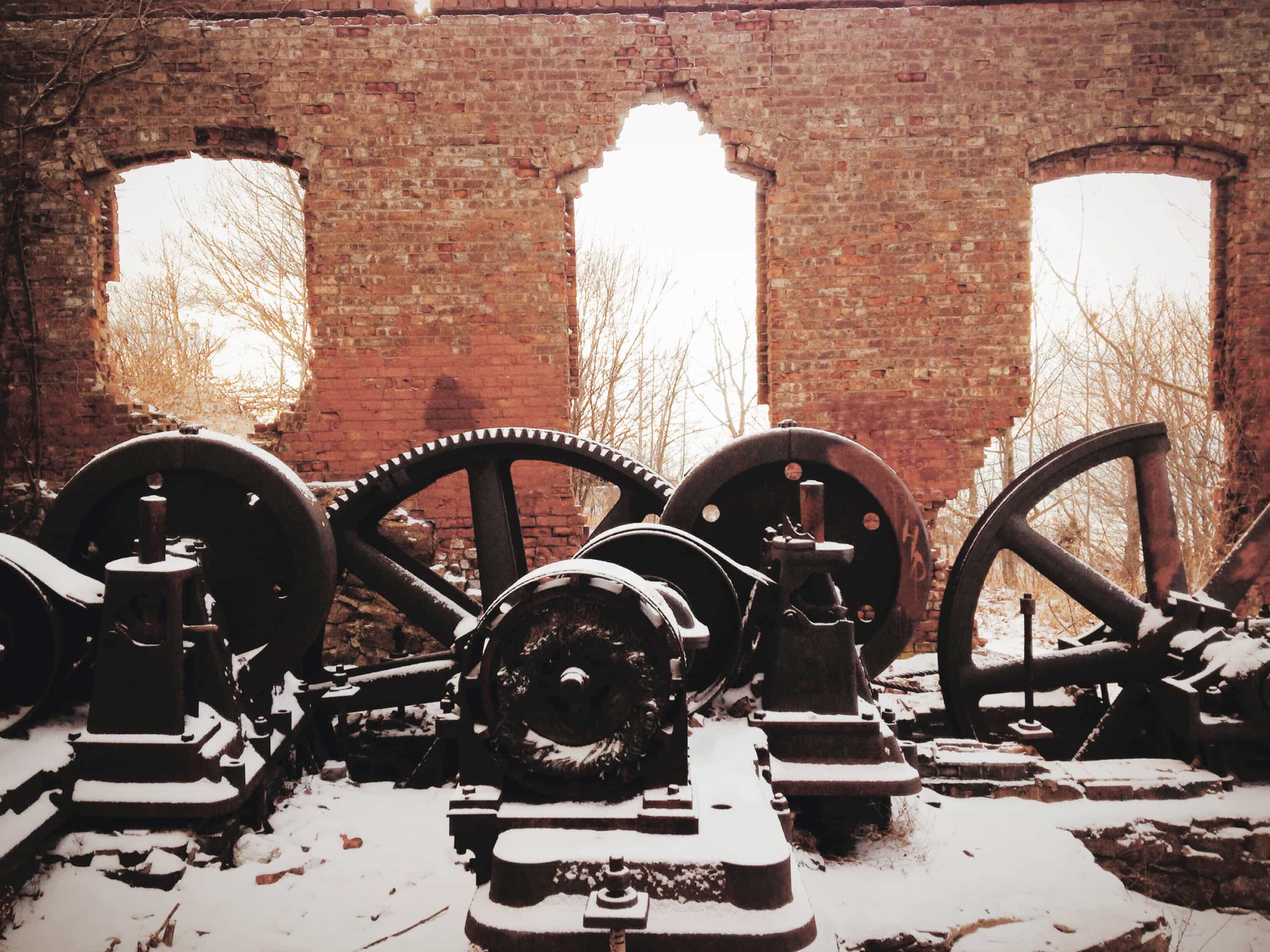
A hike up the well-marked (and sometimes crowded) trail to the top of Mount Beacon, the highest peak in the Hudson Valley, affords some of the best views in the region. At the top, you can see the city of Beacon, the Hudson River, and its across-the-river neighbor, Newburgh.. Not to mention the rest of the beautiful, hilly skyline that’s so iconic of the Hudson Valley and the nearby Shawangunk Mountains. But that’s just half the draw here; the top is also home to the remains of an old casino, and the gearhouse that used to pull trollies with passengers up the mountain. Begin your day at Beacon Bagel to carb up before your hike, or grab a picnic worthy sandwich at Harry’s Hot Sandwiches; afterward, grab a beer and pub fare at Dogwood or The Hop. For more ideas on killing the rest of a day (or weekend) in Beacon, check out out the Escape Brooklyn Guide to Beacon.
• Time: Two-ish hours up the mountain and back.
• Difficulty: After your legs turn to jelly going up 200 stairs at the beginning of the trail–not so bad. There’s a couple steep inclines too, but overall, a 6/10.
• To Get Here: Take the MetroNorth to Beacon, NY station. Take a shuttle into town, cab it, or walk 2.4 miles to the trailhead. The trail starts in the parking lot across from Bob’s Mountain Grocery (640 Wolcott Ave, Beacon, NY 12508) which is a great place to stock up on water or snacks for your hike.
Breakneck Ridge in Cold Spring, NY
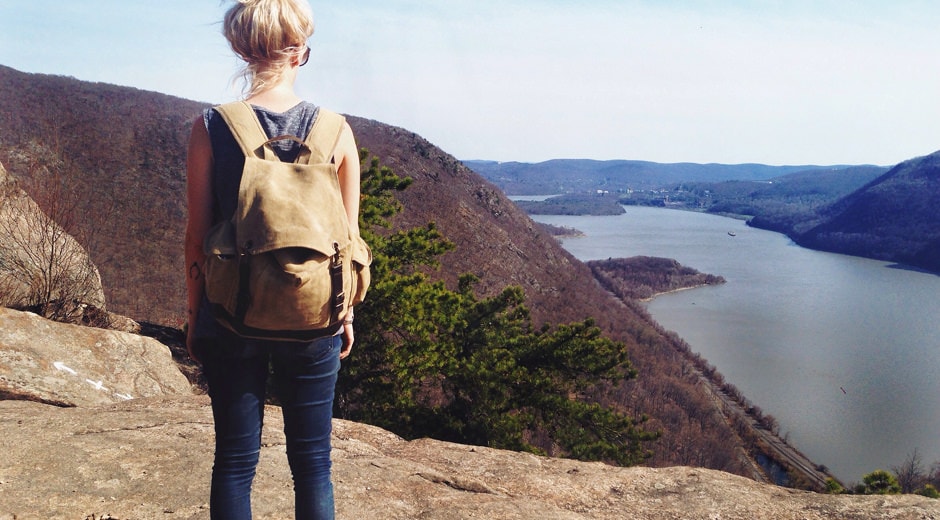
This is one of the most popular hikes in the region, and for good reason–the views at the top are insane. It’s also really easy to get to from the MetroNorth, who has weekend service directly across the road from the trailhead at the Breakneck Ridge station. The first part of this hike is an uphill climb, with multiple overlooks from its rocky cliffs that get better and better all the way up. Once you’ve reached the top, you can either head back down the way you came or finish the full loop. We’d recommend the full loop, which will put you back closer to Cold Spring, where you can grab a well-deserved beer at Whistling Willies or indulge in fresh-daily ice cream from Moo Moo’s Creamery, which is right on the waterfront park in town. For even more ideas, check out our post on Cold Spring.
• Time: Two to four hours, depending on the course you take.
• Difficulty: We won’t lie, this one requires some guts. But all the other hikers around you will make you feel better. If they can do it, you can too, right? A 10/10 if you do the longer (loop) version of the trail; a 9/10 for the short but steep switchback. The incline can be very steep and requires climbing, so wear proper shoes, bring water, and keep both your hands free at both times.
• To Get Here: Take the MetroNorth to Breakneck Ridge station on weekends; the trailhead is across the street. On weekdays, you can take the train to Cold Spring and walk or cab it to the trailhead.
Manitou Nature Preserve in Garrison, NY
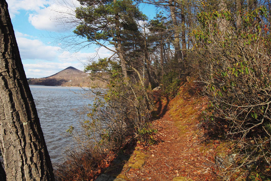
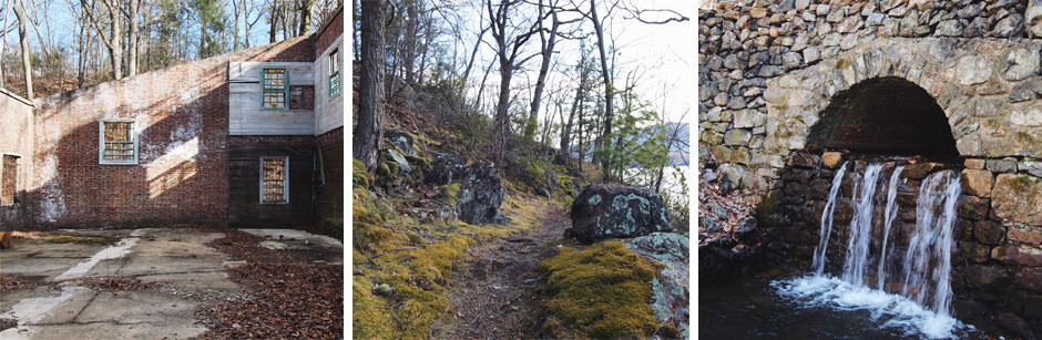
Manitou Nature Preserve is great for first-time hikers, or with folks who like to take it a little slower. An easy daytrip from NYC, this is another hike that’s easily accessible by a weekend-only stop on the MetroNorth. From the train station, the trail is quite easy to find that takes you into the heart of the preserve, where you have lots of options for hiking trails that loop through the hemlock forest and past some ruins of a brick mansion built in 1837. You can easily do all of 4-ish miles worth of trails in a day. Bring a picnic unless you plan on cabbing it to Cold Spring; also nearby is the lovely Manitoga, the house, studio and 75-acre woodland garden of mid-century designer Russel Wright.
• Time: Two hours to three hours, though you could easily kill a day here with a picnic.
• Difficulty: These trails are pretty easy. A 4/10; one requires jumping over a creek that could get wide after a bout of rain.
• To Get Here: Take the MetroNorth to Manitou, a weekends-only stop. When you get off the train, head up the hill and look for a trail on your left that looks more like a driveway with white markers. You’ll see some signs nailed to trees that indicate the trail system with a map–though you’d be hard up to get lost, take a photo of the trail system for easy reference. From there, the trail that leads into the preserve hugs the Manitou Marsh, which eventually opens up to a narrow path along the Hudson River. These are the best views of the whole hike, so take it slow to take it in (and watch your step–you definitely don’t want to fall into the Hudson River!) From there, you’ll cross the MetroNorth tracks over a bridge into the heart of the preserve, where more trails through the forest await.
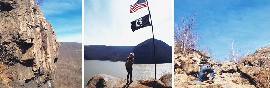
Harriman State Park, NY
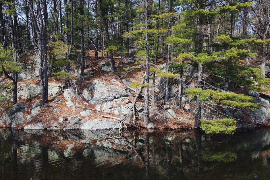
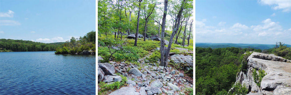
After driving through it so many times on the way to the Catskills, we recently stopped into Harriman State Park for a leisurely afternoon hike. The park is much bigger than we anticipated–and its 230 miles worth of trails can seem overwhelming with so many options. But with well-marked trails and a map, and even a shuttle system, they’re quite easy to navigate. Wanna make a weekend of it? Camp overnight at one of the parks many lean-tos, which are first-come first-serve; a weekends-only shuttle service can drop you off and pick you up each morning. Special thanks to Regina Baker who authored the longer version of this post about Harriman State Park–the three smaller photos above were also contributed by the same author.
• Time: Choose your own adventure–anywhere from a couple hours to a couple days.
• Difficulty: Trails range in difficulty from short and easy to long and difficult. Maps are highly recommended, which you can purchase at a visitor center.
• To Get Here: There’s multiple entrances to Harriman, the two of which we’d recommend are Sloatsburg and Tuxedo. If you’re feeling like you need a bit of guidance before your hike, Sloatsburg is a great choice because you’ll enter the park at the Reeves Meadow Information Center, where you can talk to a park guide firsthand and buy a map! To get here, take the NJ Transit Port Jervis line to Sloatsburg; you’ll have to transfer at the Seacaucus station. Once you arrive at the Sloatsburg station, the walk to the park entrance is a little under two miles. Walk north on Orange Turnpike/ Route 17 to Seven Lakes Drive, turn right onto Seven Lakes Drive, and walk about a mile to the Reeves Meadow Information Center. After your hike, reward yourself with $3 beers at Sterlington Station Tavern and Restaurant before catching the train back.
Alternately, the Tuxedo entrance is for you if you’re looking to end your hike right in the center of town, with multiple options for a meal within short walking distance. To get here, take the NJ Transit Port Jervis Line to Tuxedo Station. Then, head north through the parking lot and parallel to the train tracks, to East Village Road, then turn right. After you emerge from the tunnel under the bridge, turn left at the junction with Grove Drive. Watch for the blazes marked along this route. Shortly after you’ll see the Ramapo-Dunderberg trailhead on the right: enter here. Depending on your experience level, you can choose to make your hike an out and back to catch a view and return to the trailhead in under 5 miles, or you could create a loop for various views, a lakeside visit, in about 6-8 miles. After your hike, for a quick beer or a bite to eat, directly across from the train station is a little plaza with Tuxedo Sushi and Bentley’s Deli. Just a bit further down NY-17 is Tuxedo Junction Inn, a casual bar and restaurant with a friendly local vibe, serving up your standard tavern fare.
TO BE CONTINUED…
Got any favorite hikes that are accessible via public transit? Leave a comment below or email us to contribute to this article! We’d love to compile a list of great hikes done by real people. We’ll keep adding to this article, which we hope is a great resource for all our fellow New Yorkers.